 Geospatial Intelligence - Real World Solutions
With over 30 years' experience, Waypoint Mapping provides geospatial consulting for organizations of all sizes.
Specializing in visual intelligence for Disaster Response and Critical Infrastructure since 1992. Pioneers in emerging geospatial technologies including Web GIS, GPS, LiDAR and 3D visualization from satelites, UAS and manned aircraft. If your organization needs to enhance situational awareness, Waypoint Mapping can help.
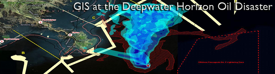
(Realtime Situation Status Map combining realtime weather, currents and forecast spill model for the Incident Command Post by Waypoint Mapping.)